 "
"
Team:Buenos Aires/ mapaarsenico
From 2013.igem.org
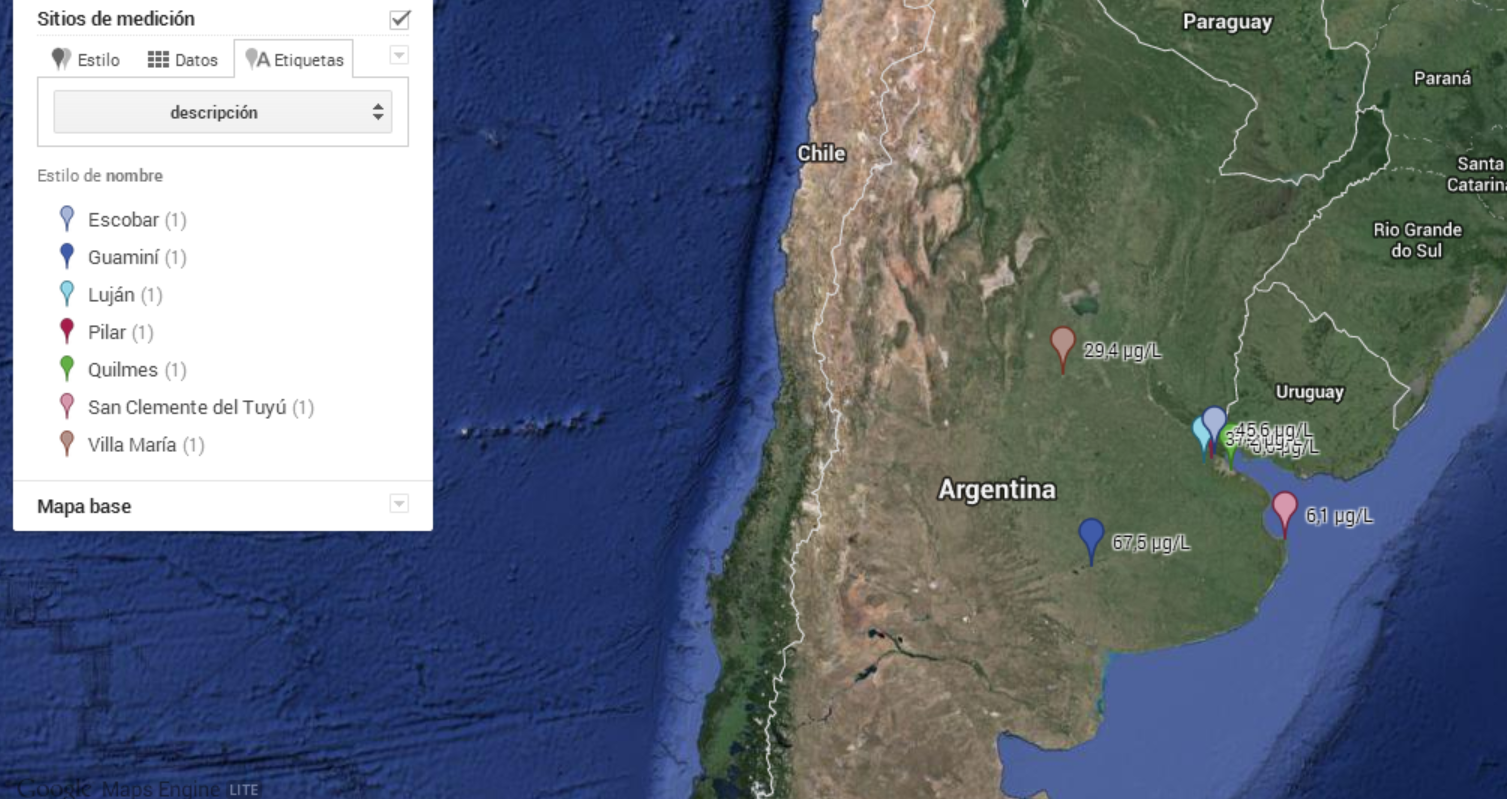
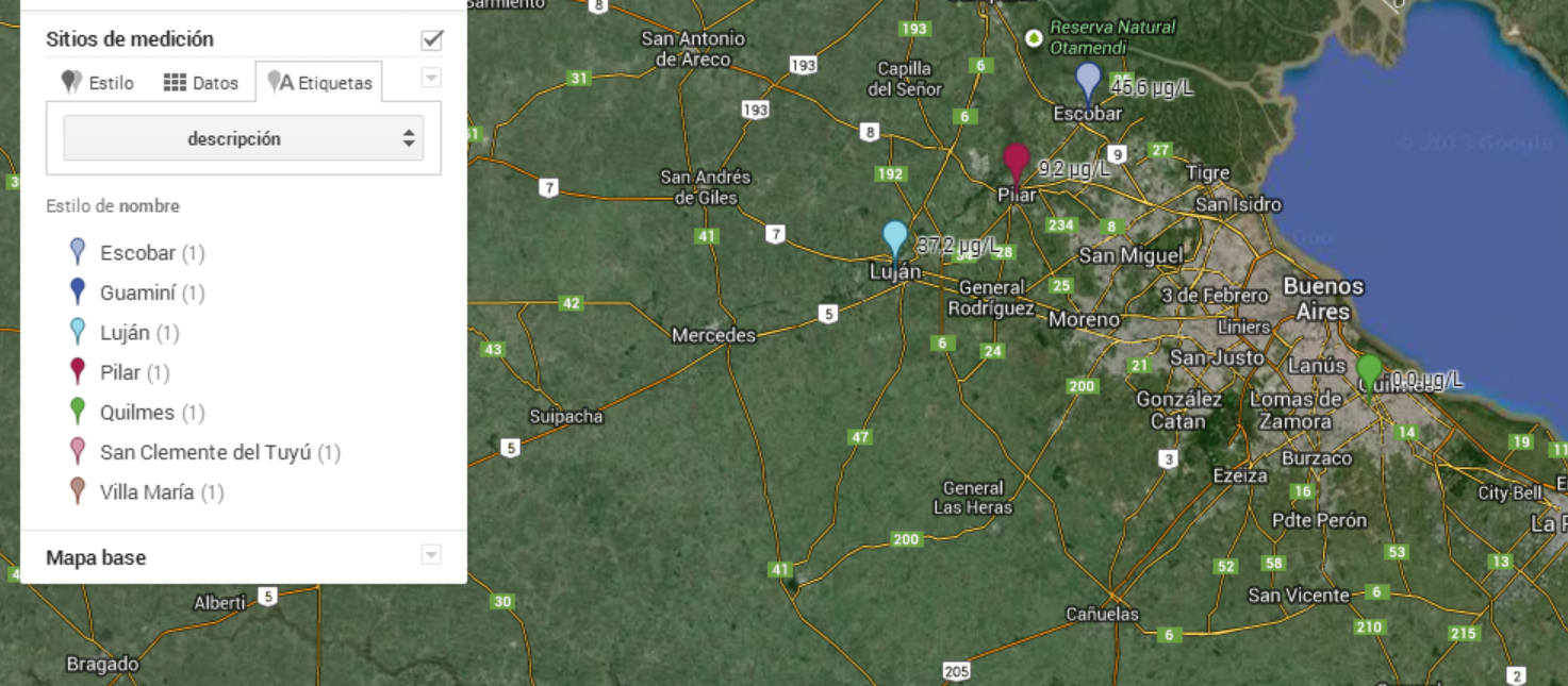
Testing water samples from different locations
Our project wouldn’t be fullfilled if we didn’t bring it to the society. To accomplish that, we are trying to make a map indicating the level of arsenite pollution in each location. However, we must know that due to the strange distribution of arsenic in groundwater,the detection of arsenic in a sample doesn't mean that the whole location is contamianted.

We have collected sample water from different towns around the country, specialy from the nearby of Buenos Aires.
Please, click on any picture if you want to see the interactive map ( where you will be able to see the concentration of arsenic in each location)